
NBWC Assists Tribes in Opposing Large Graphite Mine in Imuruk Basin
- halshepherdwpc
- May 14
- 9 min read
Graphite One, a Canadian-based mining company, seeks to extract ore from what may be the highest grade and largest graphite deposit in the United States. The mine will include an acid-generating open pit that will be over a mile in length, and approximately ¼-mile deep would have substantial impacts on one of the most biologically rich watersheds in the State. Similarly, the mining company projects the removal of 22.5 million tons of ore at the rate of 2,740 tons per day with an additional 50 million tons of waste rock and the diversion of the entire flow of Graphite Creek within the footprint of the mine. A flotation processing plant located at the mine site is projected to produce 53,600 dry metric tons of concentrated graphite per year for transport via a new road constructed through the Kigluiak Mountains to the Port of Nome, Alaska, and subsequent shipment to battery manufacturing facilities in the lower 48 states.
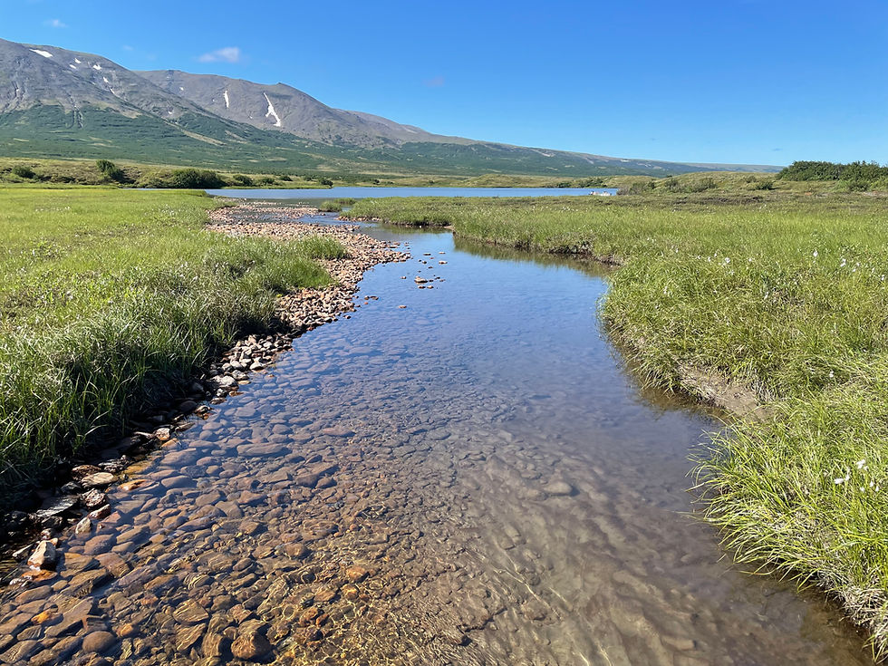
Graphite One Mine’s Impact on Rivers and Streams

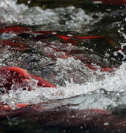
The Graphite One Mine intends to divert toxic effluent from the mine into and divert two salmon streams that are within the 1,176 acre foot print of the mine. The mining company claims that the pristine Glacier Canyon Creek (Picture above) and Graphite Creek do not contain salmon or other fish species because they contain back ground levels of heavy metals and are too acidic and therefore intends to dump so called “treated” effluent into Glacier Canyon and divert Graphite Creek around the open mining pit. However, it is ironic that while all the other rivers and streams within 2 miles of the mine contain abundent salmon except for these two creeks and the Fish Surveys that the mining company and the Alaska Department of Fish and Game are relying for the claim that these rivers do not contain salmon are flawed.
NBWC and the Native Villages of Teller, Mary’s Igloo and Brevig Mission will be conducting their own fish surveys in Glacier Canyon and Graphite Creeks during the 2026 field season to find out the truth about the existence of salmon in these creeks.
Tribes Pushing Army Corp of Engineers for Environmental Impact Statement on Mining Project in the Sacred Imuruk Basin
At this time, the Army Corps of Engineers is conducting an Environmental Assessment (EA) to determine whether the proposed project may have significant effects on the environment. At the conclusion of the EA process the agency will determine whether preparation of a more comprehensive Environmental Impact Statement is warranted or issue a Finding of No Significant Impact (FONSI) for the project. Because the mining company, however, has also obtained Fast-41 status and due to pressure from the Trump administration, the Corp has indicated that it will likely issue a FONSI in order to issue the permit by September 2026 – Just one year after the application was submitted.
The lack of an EIS to analyze the impacts of a mine of the scale of Graphite One is unprecedented.
In addition, the Native Villages of Teller, Brevig Mission and Mary's Igloo consistently complained about the Mining company has not provided the bulk of documentation needed to determine environmental impacts. They have admonished the Corp that as Cooperating and Government-to-Government Consulting entities the Tribes remain entirely in the dark as to the environmental and cultural resource impacts of the proposed mine because of this missing information.
The Corp has provided some of the information, that the Tribes requested While the Corp has stated that the recently released Environmental Evaluation Document addresses all the information requested, much of this information is labeled by Graphite One as “Proprietary” or “Unpublished.” Such reluctance to release information that serves as the basis for determining water quality and hydrogeology impacts and the details of water treatment management, tailings facility design and reclamation related to a permit application for a large mining project is unprecedented.
In addition, although the Corps agreed to additional G2G Consultation with the deputy commander of the Alaska District and other agency representatives, as is typical of Alaska based federal agencies, the Corps has little concept of the nature of such consultation. During a recent meeting between for example, in reference to the Tribe’s submission of several Tribal Consent Based Resolutions affirming the authority of the Tribal Traditional Councils to make their own decisions regarding proposed activities affecting Tribal lands, waters, data, resources and community interests, that were submitted, the Corp representatives stated that they would be added to the other comments as part of the public comment period that ended last Winter. Also when Traditional Council Members specifically requested how they can request that an EIS be conducted, another Corp representative indicated that the Council's had already made such requests as part of the public meetings held in Teller and Brevig Mission last month. Finally, there was a request that the mine not be allowed to continue without the "full, free and informed consent" of the Traditional Councils as provided by the U.N. Declaration on the Rights of Indigenous Peoples, to which there was no response.
Such responses or lack thereof are concerning because these documents were submitted and request for the additional reports and that an EIS be conducted were made as part of a Government-to-Government Consultation and therefore cannot be categorized as part of a mere public comment process. In such context, an Executive Order adopted by President Bill Clinton documentation provided by and requests made by sovereign nations as part of G2G Consultation are not to be considered as part of the standard public comment process and must be held to a higher level.
In an unusual step, While the Corps has invited the Tribes and other agencies to be Cooperating Agencies under FAST-41 process for the project, no Tribes, state agencies, or other federal agencies have been invited to serve as cooperating agencies on the EA under NEPA. Never-the-less, Greg Mazer Project Lead for the Corps states that within “this EA process, Alaska District remains committed to ensuring that the Tribes are meaningfully informed about environmental and cultural impacts early enough to provide input on our analysis and decision making process.’
In an uncharacteristic acknowledgement of tribal sovereignty and the inprecedented importance of the Imuruk Basin to the health and welfare of local Native Village communities, it appears that at the staff level at least, the Corps is attempting to include the Tribes in the decision-making process regarding the Permit. It is clear, however, that the final decision as to draft an EA or EIS, will be made higher up in the Trump administration. This is illustrated by they fact that staff defering to upper level decision makers to answer questions about the completion of the final jurisdicational determination and that the administration is already working on gutting protections of wetlands and waters.
Tribes Opposing Mine in the Arctic up against Trump Administration’s Attack on Clean Water
Access to what is likely the Graphite One Mine will require the construction of a 17.3-mile-long road cutting across salmon streams and archaeological sites, and water withdrawals from over a dozen streams, further jeopardizing already low numbers of chum and pink salmon returns at the exact time climate change is warming the Arctic.

The Native Villages of Teller, Brevig Mission, and Mary’s Igloo, and their partner organizations, have consistently opposed Graphite One’s permitting process, conducted by the U.S. Army Corps of Engineers, due to potential impacts on community health, subsistence, water, and cultural resources. And in recent weeks, that opposition has been mounting. On November 21, the Native Village of Brevig Mission Traditional Council and Village Corporation, and the City of Brevig Mission, unanimously adopted a resolution opposing the Mine. Then, the day before Thanksgiving, representatives from the City of Brevig Mission, the Brevig Mission Traditional Council, and the Native Corporation traveled across the ice-covered Grantly Harbor to meet with their counterparts in Teller to discuss further the impacts of the Mine. At the meeting, the Teller Tri-Entities and the Mary’s Igloo Traditional Council adopted more resolutions opposing the Mine and launched a comment-writing campaign for members of the public who attended. Then, on the following Friday, the three Tribes, along with the Norton Bay Watershed Council, submitted voluminous comments to the Corp, adding to a growing stack from other organizations and community members that point out multiple flaws in the Mine’s permitting process.
These flaws arise primarily out of the Corps’ obligation under the Clean Water Act to fully study the impacts of the Mine on the Imuruk Basin, an area that is almost as much water as it is dry land and is known as one of the most biologically productive and culturally rich regions in North America.[1]
The Tribes are primarily concerned that the agency is fast-tracking the application under the federal Fast-41 process,[2] and, ignoring proper analysis of environmental impacts in order to implement Trump administration executive orders favoring industrial extraction over protecting subsistence and cultural resources.[3]
A major component of the Tribes’ argument is that, to encourage the Corp to limit analysis of the Mine’s impacts, Graphite One has arbitrarily underestimated the potential impacts. Specifically, out of over 15,000 acres of land and waters within the Mine’s study area, Graphite One has estimated that the total extent of permanent impacts to wetlands and other waters would be a mere 414.68 acres and that only 2.21 acres of that are “jurisdictional” requiring analysis before the permit is issued under the Clean Water Act.[4]
The awkwardness of such low balling, however, is illustrated by a Jurisdictional Determination Report created by the consulting firm hired by the mining company to support its claim which concludes that the total extent of permanent impacts to wetlands and other waters would actually be 5,931.4 acres and the total jurisdictional waters would be 581.0 acres, greatly exceeding Graphite One’s estimated impacts.[5] In addition, while the Clean Water Act may limit environmental analysis to rivers, streams and wetlands that come under its jurisdiction, the National Environmental Policy Act requires the Corp to analyze impacts on dry land as well and therefore the entire 15,000 acres of the study area.
That the Corp appears to have bought into the ridiculously low levels of impacts of over a one mile wide mine and an over 17 mile access road as illustrated by an e-mail to the Nome Nugget newspaper sent by Graphite One Senior Vice President Kevin Trophy which states “after reviewing our project plan, the Army Corps of Engineers determined our project will not impact enough wetlands to necessitate an EIS…Given the very small wetlands footprint, the Corps made the initial decision to schedule the project as an Environmental Assessment (EA)…” thereby conveniently avoiding a complete analysis of impacts and a much reduced timeline for permitting.
To understand how this came about, one must first go back over the past decade or so, when a series of republican administrations’ primary tool for dismantling the Clean Water Act has been to drastically limit its scope.[6] Although Congress defined “navigable waters“ under the Act broadly to simply mean “Waters of the United States” (WOTUS), starting in 2001, a succession of U.S. Supreme Court opinions concluded that Congress’ use of the term “navigable waters,” somehow indicated an intent to restrict protections to only those waterways (including wetlands related to such waters) that have been traditionally navigable and ignored its previous finding that the term “navigable” was not that relevant to which waters were covered by the Act.
With 174 million acres of wetlands, more than three million lakes, and more coastland than the lower 48 combined, no other state has more to lose from weakening the definition of what can be covered by the Clean Water Act. Regardless, following last year’s decisions in Sackett v. Environmental Protection Agency, in which the Supreme Court cut back the application of the Act by restricting what can be considered WOTUS, the Trump Administration announced yet another rewrite of the Rule.
While the Administration claims to be implementing the decision in Sackett, in reality, the new Rule takes restrictions on the Act even further and would eliminate protection for the vast majority of wetlands throughout the Western U.S. and Alaska by excluding any wetland that does not have a continuous, visible surface connection to a navigable water. This would be the most restrictive reading of the Clean Water Act ever, pushing protections back to before they were even in place.
Because the Corp is one of two federal agencies that is directly involved in drafting the latest proposed Rule, it makes one wonder whether Graphite One’s outlandishly low estimate for the Mine, is because they have been working with the Corp to apply the highly restrictive definition of the draft Rule to such impacts even before it is finalized. This might explain why the mining company’s impact estimates differ even under the federal Fast-41 process and Trump administration executive orders that favor industrial extraction activities over proper environmental analysis of impacts on water and subsistence resources.
Either way, it is clear that the proposed Rule and the environmental impacts issue for the Graphite One Mine are linked and that the ultimate decision will come down from higher up, which will not be a good outcome for the local communities affected by the Mine.
[1] See generally, William Oquillick, People of the Kauwerak; Harold S. Shepherd, Return to Ekeunicks’s Time – Defending Waters and Tradition in the Arctic, pp. 63-88 (iUniverse, October 2024)(Return to Ekeunicks’s Time ).
[2] U.S. Department of Interior, Trump Administration Adds Key Mining Projects to FAST-41 Effort Aims to Expedite Critical Minerals and Secure Domestic Supply (April 18, 2025).
[3] See e.g., Immediate Measures to Increase American Mineral Production, Executive Order (March 20, 2025).
[4] Public Notice of Application for Permit - REFERENCE NUMBER: POA-2018-00210 – Graphite Creek at 2 (September 30, 2025)(Notice).
[5] Graphite Creek Project, Jurisdictional Determination Report Graphite One (Alaska), Inc. p. 42-43, Table 8 (August 25) (HDR JDR).
[6] Shepherd pp. 190 – 95.


Comments